Drone Uses at Solid Waste Disposal Facilities

Drone flights over solid waste landfill sites are fast becoming accepted as an efficient way to conduct surveys over terrain that is often difficult and/or dangerous to navigate on foot.
Couple this with the fact that you can put a drone in the sky for a lot less of a financial outlay than an airplane and making the most of this relatively new technology just makes good commercial sense.
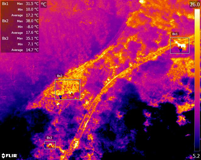
A drone can be the ideal eye in the sky to periodically survey remote areas of a landfill site or a fast method of carrying out a perimeter survey. The nature of landfill sites means that getting a person to certain areas can pose a safety risk but not so for an unmanned aerial vehicle. Real-time, high-resolution images can prove as good, if not better than a ground-level perspective. The fact that these images, either in still or video form, can be archived for later viewing or for comparison purposes only enhance their potential as a site management tool.
However, drone pilots are required by law to be examined and certified by the CAA in order to be able to fly legally. This is a challenging and lengthy process requiring annual renewal that also must be set alongside the financial cost of purchasing the state of the art equipment, including thermal imaging capabilities necessary to carry out useful survey work. So it makes perfect sense to outsource drone surveying to an already qualified, licensed, and skilled company such as Drone Media Imaging. Just get in touch to find out more.
Expert Infrared Inspections for Accurate Thermal Assessments
Need professional thermographic analysis for your project? Our certified experts use the latest infrared technology to deliver precise results. Contact Drone Media Imaging today for expert thermal imaging services.
related posts
The use of drones equipped with thermal imaging cameras has revolutionized fire safety measures in solid waste landfill sites. These drones can detect temperature variations and hotspots, allowing operators to identify areas at risk of combustion and take proactive measures to prevent fires. Additionally, thermal imaging technology can detect thermal emissions and chemical and physical parameters, providing valuable data for monitoring and managing landfill sites. This technology has already shown promising results, reducing the number of fire incidents in landfill sites and minimizing environmental impact and health risks. As the technology continues to advance, drone environmental thermal imaging is expected to become an indispensable tool in solid waste landfill site management.


