Roof Inspection via Mast not Drone
Roof inspection by Mast not Drone – Same Result!
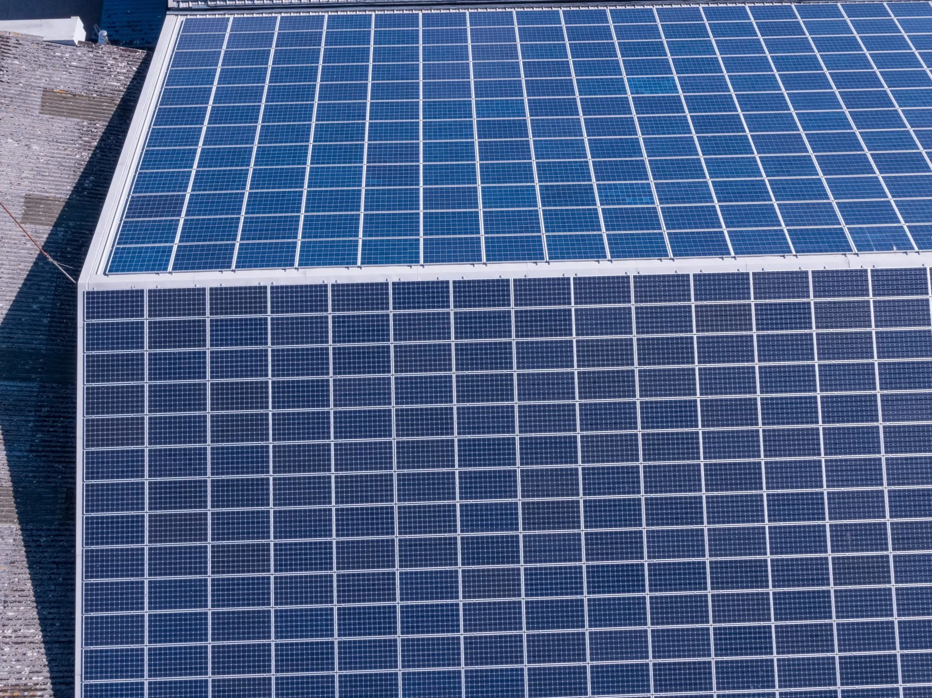
Not all roofs are best inspected by drones, sometimes it is easier and cheaper to use a mast, with none of the legal implications!
Our 15m (50ft) mast is capable of accessing roofs up to three stories for pitched roofs and 4 stories for flat roofs. We can deploy a mast without requiring airspace permissions and legal separation from vehicles, properties, vessels and people, which means we can gain access quickly, with the minimum of fuss and without the costs associated with drone aerial flights. As we use the same aerial equipment as we would for a drone flight, the results are exactly the same in terms of image quality.
We use the same DJI Zenmuse Z30, X5S and XTr cameras with our mast as we do on our drones which offer the most superior image capture available today.
With wireless connection to our ground-station and video controllers we are able to show you real-time the images from your roof, chimney and guttering, and at a very high level of detail. In particular, our Z30 zoom camera is capable of a 30x optical zoom and x6 digital zoom which offers us unparalleled access to hard to see places such as flashing and pointing, holes and cracks.
As qualified thermographers, we are also able to produce thermographic reports for solar panel inspections and flat roof water ingress issues.
You can read more about the power of the Zenmuse Z30 Inspection Zoom lens on our dedicated page here


Have a roof, chimney and gutter inspection by mast today!
GET A MAST INSPECTION QUOTATIONProfessional Commercial Aerial Inspection, Thermal, Photography and Video Filming
CAA approved & certified for UAV category 0-20kg daytime and nighttime flights Cert No.: 2565.

Expert Infrared Inspections for Accurate Thermal Assessments
Need professional thermographic analysis for your project? Our certified experts use the latest infrared technology to deliver precise results. Contact Drone Media Imaging today for expert thermal imaging services.
related posts

The dew point, a pivotal metric in weather prediction, marks the temperature at which air saturates upon cooling, impacting fog, dew, and precipitation likelihoods. Influenced by air temperature, humidity, and atmospheric pressure, it reveals condensation thresholds, vital for understanding weather patterns and climate shifts.

This guide provides an in-depth understanding of commercial roof thermography solar panel inspections, focusing on the IEC 62446-3:2017 standards. It covers the importance of these inspections, the process involved, and how to interpret the results, ensuring your solar panels are efficient, safe, and compliant with international standards.

Trained and Certified in Aerial Thermography
Drone Media Imaging use trained and certified thermographers to deliver thermographic services and inspections across many domestic, industrial and commercial sectors throughout the UK. Whether it is solar photovoltaic panel inspection in accordance with IEC 62446-3:2017 and BS EN ISO 62446-1:2016 or fire detection and management in disasters zones or underground landfill fires, Drone Media Imaging can deploy across the UK quickly, efficiently and with the right experience.
Aerial Thermography Category 2 Thermography certification to category level 2 focuses on radiometric temperature measurement analysis and the benefits of obtaining precise temperature data from challenging environments for diagnosing and reporting purposes. Whether for qualitative evaluation or quantitative evaluation our report and diagnosis analysis provide you with answers following a non-destructive inspection format from the air via UAV drones equipped with the latest technology. Drone Media Imaging is a small but unique drone operations company specialising in airborne thermal imaging across the UK. Our certification and experience when paired with our CAA enhanced OSC permissions, means we are more than capable of performing any aerial thermal imaging job however challenging. As level 2 thermographers we dive into the fundamental principles of surface emissivity, reflected temperature correction, spatial and measurement resolutions, and as a result providing clients with accurate data reporting that can be trusted.
Aerial Thermal Imaging Infrared Cameras Thermal Imaging cameras capture the reflected radiation from a surface or heat source and convert the recorded temperatures to an image map for analysis. This unique worldview provides numerous advantageous and cost-effective non-destructive options for commercial and residential needs. Aerial thermal cameras of the highest quality provide non-contact temperature measurements in difficult to reach locations that cannot be observe from the ground. As is the case with all drone inspections, the hazards connected with operating at a height are minimised as is the potential of inflicting damage to the structure during the inspection procedure.
Case Study – Explosion at a Grain Store Port of Tilbury London Following an explosion at the Port of Tilbury London grain store in July 2020, Drone Media Imaging were hired to provide aerial thermal data support to emergency service gold commanders and the senior management for the grain store. Flying thermographic data collection missions, hourly, daily, and weekly for over 13 months from the initial explosion and subsequent silo fires, we provided important thermal data reports as the fire developed, enabling the fire management strategy to be accurately measured over time. Comprehensive reports, thermal imaging, RGB photography, and video pictures were used to provide the information essential to effectively manage the problem until the building was destroyed in 2020.