Precision Photogrammetry Surveys – High-Accuracy 2D & 3D Aerial Mapping
Advanced Drone-Based Surveying for Infrastructure, Agriculture, Mining & Environmental Monitoring
Industry-Leading Drone Mapping | High-Resolution 3D Models | Accurate Terrain & Volume Analysis
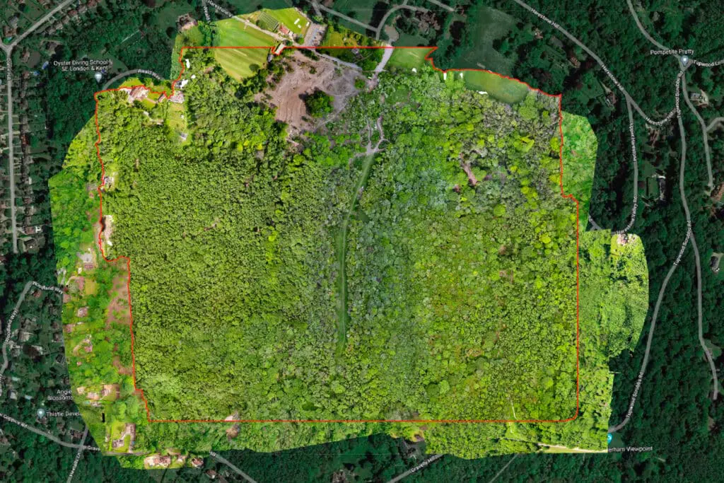
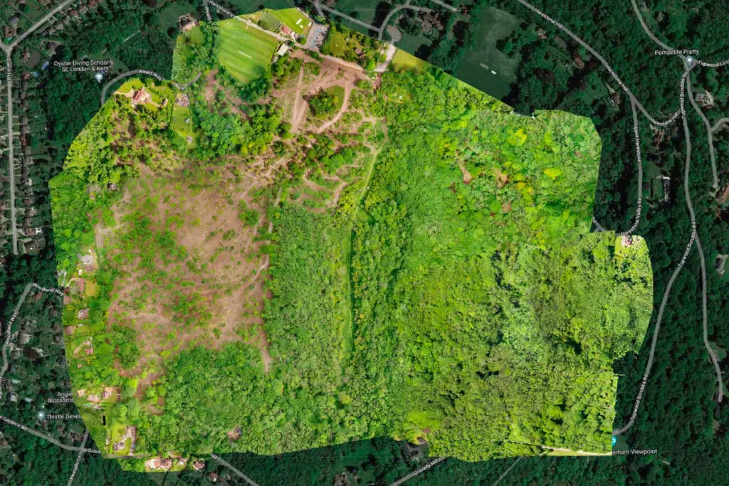
Photogrammetry surveys provide precise 2D and 3D mapping for land assessment, infrastructure development, environmental monitoring, and industrial applications. Using high-resolution drone imaging, we capture detailed geospatial data to create accurate digital models, topographic maps, and volumetric calculations. This advanced surveying method is now the industry standard across multiple sectors, offering faster, safer, and more cost-effective solutions for engineers, land surveyors, environmental consultants, and planners.

Our advanced photogrammetry surveys provide high-resolution 2D and 3D mapping for forestry, mining, infrastructure, agriculture, and civil engineering projects. Using drone-based photogrammetry, we generate precise geospatial models to assess terrain, structures, and environmental changes. Whether you need volume calculations for mining, forest canopy analysis, or coastal erosion monitoring, our high-accuracy drone mapping solutions deliver cost-effective, data-driven insights for planning, development, and resource management.
“Unlock precise, high-resolution aerial mapping with expert drone photogrammetry surveys. From construction and infrastructure planning to forestry, mining, and environmental monitoring, our advanced 2D and 3D mapping solutions provide accurate geospatial data for smarter decision-making

What is Photogrammetry & How Does it Work?
State-of the-Art UAV equipment dedicated to Industrial scale mapping
Photogrammetry is the process of capturing high-resolution aerial images and using them to generate precise 2D and 3D maps, terrain models, and volume calculations. By using specialist drone-mounted cameras, we collect overlapping images from multiple angles, which are then processed into georeferenced digital models that accurately represent the physical environment.
This technology revolutionises surveying and mapping, offering unmatched precision and efficiency in land analysis, infrastructure planning, and resource management. Unlike traditional surveying methods, which can be labour-intensive and costly, drone photogrammetry provides rapid, large-scale data collection with exceptional accuracy and minimal disruption.
Applications of Aerial Photogrammetry
Photogrammetry has become an essential tool in industries ranging from construction and infrastructure to environmental monitoring and agriculture. The ability to generate precise topographic models and accurately measure land changes makes it an invaluable resource for planners, engineers, and land surveyors. Some key applications of drone-based photogrammetry include:

Why Choose Drone Media Imaging for Photogrammetry Surveys?
Specialist Drone Surveying & High-Accuracy Data Processing
At Drone Media Imaging, we use state-of-the-art UAVs equipped with high-resolution mapping cameras and advanced photogrammetry software. Our expertise in 3D terrain modelling, digital orthophotography, and volumetric analysis allows us to deliver high-precision data tailored to your project requirements.
Fast, Efficient & Cost-Effective Aerial Surveys
Unlike traditional surveying methods that can take days or weeks, drone-based photogrammetry can capture high-resolution aerial data within hours, significantly reducing project timelines and costs. Whether you need a detailed topographic survey or volume calculations for construction or mining, we provide actionable insights that drive efficiency and accuracy.
FAQs – Photogrammetry Surveys & 3D Mapping
We generate digital surface models (DSM), terrain models (DTM), volume calculations, contour maps, and orthomosaic imagery for detailed site assessments.
Yes, we capture shoreline changes over time, helping environmental agencies track coastal erosion, flooding risks, and land movement.
We provide precision agriculture surveys, analysing soil quality, crop health, and plant density to improve yield optimisation and land management.
Our drone photogrammetry achieves centimetre-level accuracy, providing highly detailed 2D and 3D models for precise measurements and analysis.
Industries such as construction, agriculture, mining, forestry, civil engineering, and environmental monitoring rely on photogrammetry for accurate land assessments and planning.
Drone photogrammetry provides accurate volumetric calculations for stockpile management, excavation tracking, and site planning. Mining companies use this data to monitor extraction rates, optimise material transportation, and improve safety compliance without the need for manual surveying in hazardous areas.
Yes, drone photogrammetry is widely used in civil engineering projects, road planning, and bridge surveys. By capturing high-resolution topographic data, engineers can assess terrain, measure gradients, and identify potential obstacles, ensuring accurate design and construction planning.
Survey duration depends on site size, but most aerial mapping projects are completed within a day, with data processing typically delivered in 24-48 hours.
Yes, drone-based photogrammetry can be combined with multi-spectral and thermal imaging to assess water clarity, surface temperature variations, and hydrological patterns. This is particularly useful for environmental monitoring, flood risk assessments, and aquatic ecosystem health studies.
While it doesn’t replace all manual surveying techniques, it offers greater efficiency, speed, and accuracy for large-scale mapping and terrain modelling.